

Aerial Services Partnership Surveying
Common Deployments
-
![]()
Farming & Rural
-
![]()
Airports & Harbours
-
![]()
Mining Sector
-
![]()
Industrial Sector
-
![]()
Urban Construction
-
![]()
Residential Construction


DC Geomatics has the ability to facilitate fully licensed and insured Drone Surveying on any site including complex and high-risk environments such as Mining, Oil and Gas installations.
How can drones benefit Surveying & Mapping operations?

Reduce field time and survey costs
Provide accurate and exhaustive data
Map otherwise inaccessible areas
How to use drones in Surveying & Mapping?
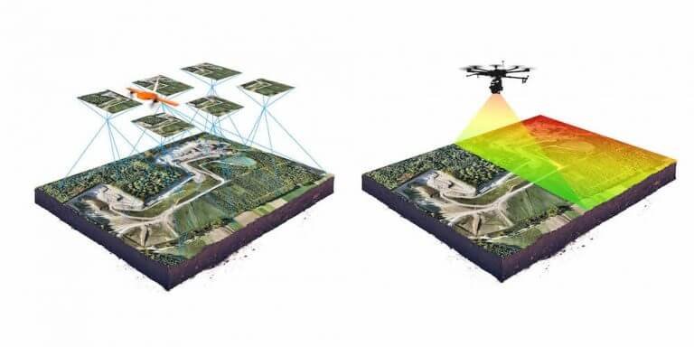
Land surveying/cartography
Land management and development
Precise measurements
Stockpile volumetric measurements
Slope monitoring
Urban planning

Surveying & Mapping Drones
Want to know more about our Managed Aerial Services Program?
Visit the partner enquiry page or contact us by filling in the form and one of our staff members will get back to you shortly.